1927
Maker: Boston City Planning Board
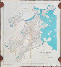
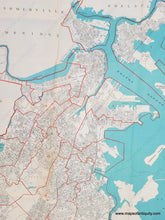
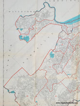
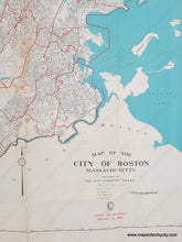
Antique map of Boston published c. 1927 by the City Planning Board of Boston. This nearly undocumented map is a reduced size version of the first municipal map to be published in the history of the city. In their 1927 Annual Report, the Planning Board wrote "During the past year the Board has completed a new wall map of the City of Boston and has arranged for its publication on the scale of 800 feet to the inch, and also reduced to the scale of 1,600 feet to the inch. This is the first municipal map to be published in the history of the city and has been copyrighted in the name of the City Planning Board of the City of Boston....The preparation of this map was considered a necessary undertaking for the reason that the latest available 800 foot scale map of the City of Boston was published in 1915....Plans are being made to place one for these wall maps in each department of the city free of charge, together with a limited number of the smaller maps." Unlike the larger version, this map is not dated and it includes ward boundaries shown in red. This map was folded and was probably tucked away for many years, which is why it is in better shape than some examples of the larger version that can be found. It is in good to very good antique condition with some wear and small separations along the folds, some minor wrinkles, and some toning at the top edge. Measures approx. 39.75 x 35.25 inches to the neatline.
Item Number: BOS015


