Current hours: 10am to 5pm Tuesday through Saturday. We are closed Sundays and Mondays for the Winter. Proud to be a SMALL, LOCAL, CAPE COD BUSINESS! Maps of Antiquity is in its 38th year! Our maps are only available at our website www.mapsofantiquity.com or at our store!

Genuine-Antique-Map-Plate-23-Part-of-Ward-4-City-of-Boston-Copley-Square--1938-Bromley-Maps-Of-Antiquity
  • Load image into Gallery viewer, Genuine-Antique-Map-Plate-23-Part-of-Ward-4-City-of-Boston-Copley-Square--1938-Bromley-Maps-Of-Antiquity
  • Load image into Gallery viewer, Genuine-Antique-Map-Plate-23-Part-of-Ward-4-City-of-Boston-Copley-Square--1938-Bromley-Maps-Of-Antiquity

1938 - Plate 23, Part of Ward 4, City of Boston (Copley Square) - Antique Map

Regular price
$165.00
Sale price
$165.00
Regular price
Sold out
Unit price
per 
Shipping calculated at checkout.

Item number: BOS019
Genuine Antique Map

1938

Maker: Bromley

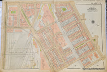
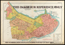
Antique map of part of Boston from the Atlas of the City of Boston, Boston Proper and Back Bay, by G.W. Bromley & Co. 1938. This map includes Copley Square and the Boston Public Library, the Prudential Center is located where the Back Bay Railroad Yard is on this map, Columbus Square, Boylston St, Columbus Ave, and Huntington AVe. With property owners names and vibrant original printed color to indicate the types of buildings for tax and insurance purposes (pink is brick, brown is stone, yellow is frame or wood, and blue is iron). Fair to good condition with wear at the edges of the paper, some mild staining, some wear along the fold. This map was backed on fabric after being printed, to make it sturdy. Should frame nicely and imperfections at edges can be hidden under a mat. Measures approx. 23 x 33 inches to the paper edges.

Item Number: BOS019