Genuine-Antique-Map-Brussels-Belgium---Plan-de-Bruxelles-Europe-Belgium-1897-Society-du-Grand-Maps-Of-Antiquity-1800s-19th-century
1897 - Brussels, Belgium - Plan de Bruxelles - Antique Map
  • Load image into Gallery viewer, Genuine-Antique-Map-Brussels-Belgium---Plan-de-Bruxelles-Europe-Belgium-1897-Society-du-Grand-Maps-Of-Antiquity-1800s-19th-century
  • Load image into Gallery viewer, 1897 - Brussels, Belgium - Plan de Bruxelles - Antique Map
  • Load image into Gallery viewer, 1897 - Brussels, Belgium - Plan de Bruxelles - Antique Map

1897 - Brussels, Belgium - Plan de Bruxelles - Antique Map

Regular price
$95.00
Sale price
$95.00
Regular price
Sold out
Unit price
per 
Shipping calculated at checkout.

Item number: EUR2709
Genuine Antique Map

1897

Maker: Society du Grand.

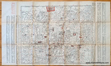
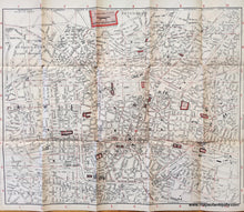
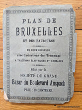
Antique printed color folding tourist map of Brussels, Belgium, by Society du Grand, 1897. This map shows the city with tramways, streets, notable edifices, and the Exposition Internationale de Bruxelles. The Exposition was open from May to November 1897; there were 27 participating countries and approximately 7.8 million people attended. This map focuses on the city, not the exposition area. Text in red in the upper left indicates notable structures, curiosities, and buildings. Text on the sides in black is a street index. Fair condition with wear along the fold lines, some separations along the fold lines, and toning of the paper. Paper is quite fragile. Original jacket is attached to the back. Measures approx. 17.5 x 21.5 inches to the neatline.

Item Number: EUR2709