c. 1950s
Maker: Frank Keating / The Cape Breton Tourist Association.
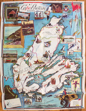
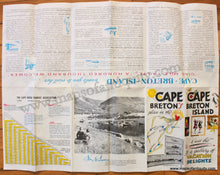
Antique printed color antique folding map of Cape Breton, Nova Scotia, Canada. The map was done by Frank Keating and was published as a tourism pamphlet by The Cape Breton Tourist Association., c. 1950s. The map features illustrations and vignettes showing beautiful views, popular pastimes, activities, notable buildings, local fauna, and more. Verso includes descriptive and historical text and some photos. Vibrant original color. With folds as issued. Very good condition. Approx. 23.75 x 18 inches to the paper edges.
Item Number: CAN315


