Winter hours: Tuesday - Saturday 10am to 5pm. Close Sundays and Mondays until May. We appreciate your business!

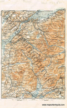
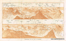
Antique-Printed-Color-Map-Carnarvon-(Caernarfon)-Verso:-Panorama-from-the-Top-of-Snowdon-Europe-England-&-Wales-Town-&-City-Views-1927-Baedeker-Maps-Of-Antiquity
1927 - Carnarvon (Caernarfon), Verso: Panorama from the Top of Snowdon - Antique Map
  • Load image into Gallery viewer, Antique-Printed-Color-Map-Carnarvon-(Caernarfon)-Verso:-Panorama-from-the-Top-of-Snowdon-Europe-England-&-Wales-Town-&-City-Views-1927-Baedeker-Maps-Of-Antiquity
  • Load image into Gallery viewer, 1927 - Carnarvon (Caernarfon), Verso: Panorama from the Top of Snowdon - Antique Map

1927 - Carnarvon (Caernarfon), Verso: Panorama from the Top of Snowdon - Antique Map

Regular price
$30.00
Sale price
$30.00
Regular price
Sold out
Unit price
per 
Shipping calculated at checkout.

Item number: TOW412
Genuine Antique Printed Color Map

1927

Maker: Baedeker.

Antique printed color map of the royal town of Caernarfon, in Gwynedd, Wales, with a verso illustration showing a panoramic view from the top of Snowdon. By Wagner and Debes, published by Baedeker, 1927. Map of Caernarfon is detailed and includes topographical details. Panoramic View includes information on what is within view, including the heights of visible mountains. With fold, as issued. Very good overall antique condition with some mild toning of the paper. Measures approximately 8" x 5.75" to the neatline, with sections of the map extending slightly past the neatline.

Item Number: TOW412