OPENING LATE ON THURSDAY Feb 13th. Thank you for your understanding! Current hours: 10:30am to 5pm Tuesday through Saturday. We are closed Sundays and Mondays for the Winter. IMPORTANT PLEASE NOTE: We have become aware that some of our photos have been stolen by other websites. Our maps are only available at our website www.mapsofantiquity.com or at our store!

Genuine-Antique-Topographic-map-Castleton-and-West-Rutland-Vermont-VT-Antique-Topo-Map-Antique-Geological-&-Topographical-Maps-Vermont-1900-USGS-Maps-Of-Antiquity-1800s-19th-century

1900 - Castleton and West Rutland, Vermont, VT Antique Map Topo Map - Antique Map

Regular price
$50.00
Sale price
$50.00
Regular price
Sold out
Unit price
per 
Shipping calculated at checkout.

Item number: TOP28
Genuine Antique Topographic map
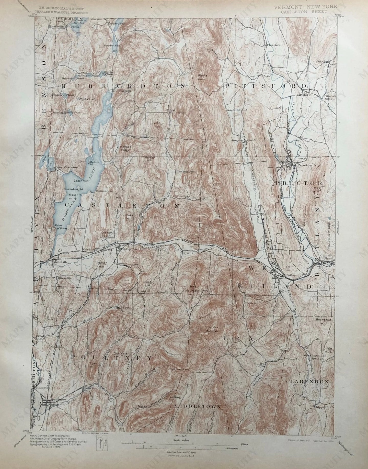
1900

Maker: USGS.

Antique topographic map of the Castleton, Vermont area including Rutland, West Rutland, Proctor, Poultney, Hubbardton, Pittstown, Lake Bomoseen and railroad lines. Very good condition. Sheet size is 20"h x 16"w.

Item Number: TOP28