1856
Maker: Chapman.
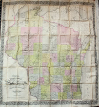
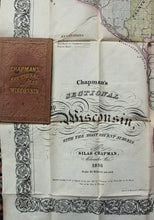
Colorful folding map of Wisconsin, includes Northern Wisconsin, WI, includes outer case. Decorative border. Wisconsin was admitted to the Union in 1848. This map show the state just a few years after that, with early town and county lines. The Erie Canal facilitated the travel of both Yankee settlers and European immigrants to Wisconsin Territory. The growing population allowed Wisconsin to gain statehood on May 29, 1848, as the 30th state. Between 1840 and 1850, Wisconsin's non-Indian population had swollen from 31,000 to 305,000. More than a third of residents (110,500) were foreign born, including 38,000 Germans, 28,000 British immigrants from England, Scotland, and Wales, and 21,000 Irish. Another third (103,000) were Yankees from New England and western New York state. Only about 63,000 residents in 1850 had been born in Wisconsin. Map is 34" x 31 1/2", Good to very good antique condition with minor seam separations. Could be restored and flattened for an additional cost. **NOTE- because this map requires extra insurance for shipping, an additional charge will appear on your card after your original purchase. If you would like to know what that charge will be, please contact us.**
Item Number: MWE222


