1853
Maker: U.S. Coast Survey.
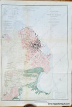
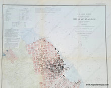
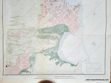
Antique city plan and coastal chart of San Francisco and San Francisco Bay published by the US Coast Survey in 1853. With details of streets and building footprints, as well as numbered key to public buildings and tidal information. Also shows topography and soundings. Shows the Mission Dolores. This map shows the results of the California Gold Rush: Its 1847 the population was said to be 459... The California Gold Rush brought a flood of treasure seekers (known as "forty-niners", as in "1849"), raising the population from 1,000 in 1848 to 25,000 by December 1849. This map shows the city a few years later in 1853. Recent hand-coloring. Folds as issued. Very good overall antique condition, with some slight wrinkling at the paper edges. Measures approx. 25.25 x 17.5 inches.
Item Number: TOW068HC


