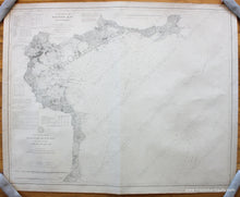
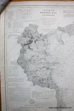
1892
Maker: U.S. Coast Survey.
Black and white antique coastal chart, first published in 1877 with additions to 1892, stamped printed Nov.1. This is part of a two chart set that covers the coast from Cape Ann to Cape Cod. The coordinating chart can be seen by searching our website for MAS294. Very good overall antique condition, with soundings, and information on tides, light houses, buoys, tides. Approx. 30.75 x 38.5 inches. **NOTE- because this map requires extra insurance for shipping, an additional charge will appear on your card after your original purchase. If you would like to know what that charge will be, please contact us.**
Item Number: NAU346


