Winter hours: Tuesday - Saturday 10am to 5pm. Close Sundays and Mondays until May. We appreciate your business!

Genuine-Antique-Map-Historical-Map-of-the-State-of-Connecticut-1930s-Des-Rosiers-Historical-Map-Bureau-Maps-Of-Antiquity
  • Load image into Gallery viewer, Genuine-Antique-Map-Historical-Map-of-the-State-of-Connecticut-1930s-Des-Rosiers-Historical-Map-Bureau-Maps-Of-Antiquity
  • Load image into Gallery viewer, Genuine-Antique-Map-Historical-Map-of-the-State-of-Connecticut-1930s-Des-Rosiers-Historical-Map-Bureau-Maps-Of-Antiquity
  • Load image into Gallery viewer, Genuine-Antique-Map-Historical-Map-of-the-State-of-Connecticut-1930s-Des-Rosiers-Historical-Map-Bureau-Maps-Of-Antiquity
  • Load image into Gallery viewer, Genuine-Antique-Map-Historical-Map-of-the-State-of-Connecticut-1930s-Des-Rosiers-Historical-Map-Bureau-Maps-Of-Antiquity
  • Load image into Gallery viewer, Genuine-Antique-Map-Historical-Map-of-the-State-of-Connecticut-1930s-Des-Rosiers-Historical-Map-Bureau-Maps-Of-Antiquity

1930s - Historical Map of the State of Connecticut - Antique Map

Regular price
$125.00
Sale price
$125.00
Regular price
Sold out
Unit price
per 
Shipping calculated at checkout.

Item number: CON460
Genuine Antique Map

1930s

Maker: Des Rosiers / Historical Map Bureau


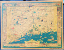
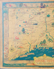
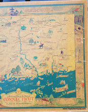
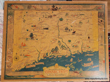
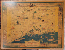
Antique map of Connecticut by Leon L. Des Rosiers and published by the Historical Map Bureau. This wonderful Connecticut pictorial map from the 1930s shows historical drawings with informational notes about the state. Includes famous places, birthplaces, rivers, and local industries. The decorative border around the map features notable places and historical events. Vibrant original color. Mounted on a board and varnished. The varnish caused the light to reflect in some of the photos, which is why we have included additional photos in different lighting. The darker indoor photos reflect the color more accurately. This map has darkened over time and is in fair to good antique condition with some surface damage. Measures approx. 16.5 x 21.75 inches to the border line.


Item Number: CON460