1874
Maker: Beers.
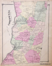
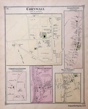
Antique hand colored map of the Town of Cornwall, Connecticut, from F.W. Beers' County Atlas of Litchfield, 1874, with villages and districts of the time delineated by color, showing major roads, railroads, property owners, schools, churches, cemeteries, businesses, the Housatonic River on its western border and Mohawk Mountain and the future site of Mohawk State Forest on the eastern border, as well as Cream Hill Lake and Mohawk Pond; verso displays maps of the Villages of Cornwall, West Cornwall and Cornwell Centre, as well as the Villages of Goshen Centre and West Goshen in the Town of Goshen. Very good antique condition with overall toning, measures approx. 14 x 11 inches.
Item Number: CON315


