Current hours: 10am to 5pm Monday through Saturday. 12pm to 5pm Sundays. IMPORTANT PLEASE NOTE: We have become aware that some of our photos have been stolen by other websites. Our maps are only available at our website www.mapsofantiquity.com or at our store!

Genuine-Antique-Print-New-York-and-Environs-view--1869-Shannon-&-Rogers-New-York-Manual-Maps-Of-Antiquity
Genuine-Antique-Print-New-York-and-Environs-view--1869-Shannon-&-Rogers-Maps-Of-Antiquity
  • Load image into Gallery viewer, Genuine-Antique-Print-New-York-and-Environs-view--1869-Shannon-&-Rogers-New-York-Manual-Maps-Of-Antiquity
  • Load image into Gallery viewer, Genuine-Antique-Print-New-York-and-Environs-view--1869-Shannon-&-Rogers-Maps-Of-Antiquity
  • Load image into Gallery viewer, Genuine-Antique-Print-New-York-and-Environs-view--1869-Shannon-&-Rogers-Maps-Of-Antiquity
  • Load image into Gallery viewer, Genuine-Antique-Print-New-York-and-Environs-view--1869-Shannon-&-Rogers-Maps-Of-Antiquity
  • Load image into Gallery viewer, Genuine-Antique-Print-New-York-and-Environs-view--1869-Shannon-&-Rogers-Maps-Of-Antiquity

1869 - New York and Environs - Antique Map

Regular price
$460.00
Sale price
$460.00
Regular price
$575.00
Sold out
Unit price
per 
Shipping calculated at checkout.

Item number: CSMT140
Genuine Antique Print

1869

Maker: Shannon & Rogers


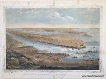
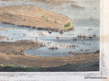
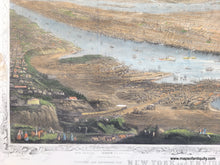
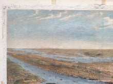
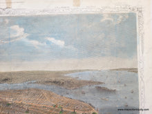
Antique bird's-eye view of Manhattan with Brooklyn and other areas around New York City, by W.C. Rogers published in Joseph Shannon's Manual of the Corporation of the City of New York aka the New York Manual in 1868. This handsome view shows the city as it was in 1868, when the church towers were the tallest structures- long before sky scrapers. Ships of all sorts fill the waters, with many more ships docked along the wharves, and the only bridges are in Upper Manhattan. A delicate border surrounds the image and labels at the border indicate areas on the image. Good condition; this map has been restored but some stains remain on the edges. It has been flattened and backed with light-weight paper but the original folds are visible. Border is slightly cut off on lower left as issued in the manual in which it was published. Measures approx. 12.25 x 16.5 inches to the paper edges.


Item Number: CSMT140