Genuine Antique Map
1730
Maker: Adair / Cooper
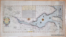
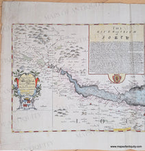
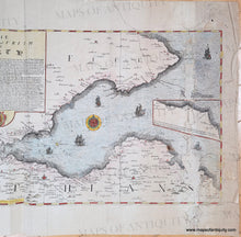
Extremely rare map of the Firth of Forth, Scotland, by civilian marine surveyor and cartographer John Adair, engraved by Richard Cooper, published 1730. Adair was the foremost surveyor of Scotland in the late 1600s, and was appointed to conduct a hydrographical survey of the Scottish coast by a special act of Scottish Parliament to be funded by a tax on vessels entering Scottish ports. This map shows the Firth of Forth and the River Forth, with Edinburgh and the many towns and cities nearby. Glasgow is included in the lower left corner. This map was dedicated to George, Earl of Morton and includes a large narrative about the river and area. Inset map is a continuation of the south coast. Includes ships, compass rose, decorative cartouche, and Scotland's coat of arms. Poor to fair antique condition with notable damage on the right side that was repaired by a previous owner. Some or all of the color was likely added later. Very rare- we can find only two examples: One in the National Library of Scotland, and one in the National Library of France. Measures approx. 12 x 27 inches to the neatline.
Genuine Antique Map from 1730
Item Number: CSMT173


