1579
Maker: Ortelius
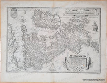
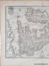
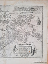
Antique map of England, Wales, Scotland, and Ireland by Abraham Ortelius, c. 1579. Also includes a section of the northern coast of France. North is oriented to the right. From an edition of Theatrum Orbis Terrarum with Latin text, published around 1579. Shows cities, towns, rivers, some topography. Interesting early spellings (Londen instead of London, Edenborg instead of Edinburgh, Dublyn instead of Dublin). With ships, decorative cartouches, a coat of arms, and scale of miles. Very good antique condition with minor stains, mostly in the margins but one spot in the description. Measures approx. 13.5 x 19.5 inches to the neatline.
Genuine Antique Map from 1579
Item Number: CSMT178


