Pickup available at 1409 MAIN ST, CHATHAM MA
Usually ready in 24 hours
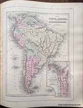
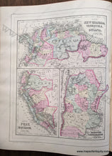
1884 - Double-sided map: Map of South America showing its Political Divisions; verso: Map of New Granada, Venezuela, and Guiana / Map of Peru and Equador / Map of the Argentine Confederation - Antique Map
-
1409 MAIN ST, CHATHAM MA
Pickup available, usually ready in 24 hours1409 Main Street
Chatham MA 02633
United States+15089451660
1884
Maker: Mitchell.
Antique hand colored maps from Mitchell's 1884 New General Atlas. On one side of this page is a map of South America, on the other side are three maps of South American countries: Colombia, Venezuela, Guyana, Suriname, and French Guiana, Ecuador and Peru, and Argentina. Shows railways, political boundaries, cities, water bodies, as well as land features. Colored by country / region. This map is in very good antique condition with minor overall toning. Paper is a bit fragile. Page measures approximately 15 x 12 inches.
Item Number: SAM402


