1888
Maker: Tunison.
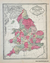
Antique double-sided sheet from Tunison's Peerless Universal Atlas of the World, c. 1888 by H.C. Tunison. The two-page centerfold is a map of Europe, colored by country, during the time of the Austrian and Prussian Empires. There are two maps on the back: on one side is a map of England and Wales colored by county, on the other side is a map of Scotland colored by county. Vibrant original color. Good antique condition with some minor signs of age. Centerfold measures approx. 14 x 22 inches to the paper edges, while back side pages measure approx. 14 x 11 inches.
Item Number: EUR2661


