Genuine-Antique-Map-Printed-on-Silk-Théatre-de-la-Guerre-dans-le-Bannat-de-Temeswar-1738-Etiene-Briffaut-Maps-Of-Antiquity
  • Load image into Gallery viewer, Genuine-Antique-Map-Printed-on-Silk-Théatre-de-la-Guerre-dans-le-Bannat-de-Temeswar-1738-Etiene-Briffaut-Maps-Of-Antiquity
  • Load image into Gallery viewer, Genuine-Antique-Map-Printed-on-Silk-Théatre-de-la-Guerre-dans-le-Bannat-de-Temeswar-1738-Etiene-Briffaut-Maps-Of-Antiquity
  • Load image into Gallery viewer, Genuine-Antique-Map-Printed-on-Silk-Théatre-de-la-Guerre-dans-le-Bannat-de-Temeswar-1738-Etiene-Briffaut-Maps-Of-Antiquity
  • Load image into Gallery viewer, Genuine-Antique-Map-Printed-on-Silk-Théatre-de-la-Guerre-dans-le-Bannat-de-Temeswar-1738-Etiene-Briffaut-Maps-Of-Antiquity
  • Load image into Gallery viewer, Genuine-Antique-Map-Printed-on-Silk-Théatre-de-la-Guerre-dans-le-Bannat-de-Temeswar-1738-Etiene-Briffaut-Maps-Of-Antiquity

1738 - Théatre de la Guerre dans le Bannat de Temeswar - Antique Map

Regular price
$250.00
Sale price
$250.00
Regular price
Sold out
Unit price
per 
Shipping calculated at checkout.

Item number: EUR2800
Genuine Antique Map Printed on Silk

1738

Maker: Etiene Briffaut

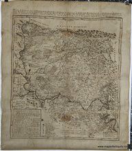
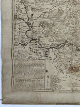
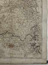
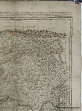
Interesting and unusual antique map of parts of Serbia and Romania, by Etiene Briffaut, c. 1738. This map shows the "Theater of War in the Banat of Temeswar." Includes Belgrade, Timisoara, Vidin, Arad, and more. The Banat of Temeswar or Banat of Temes was a Habsburg province that existed between 1718 and 1778. From 1718 to 1739, Banat of Temeswar included not only the Banat region, but also parts of present-day eastern Serbia along the southern bank of the Danube river. Following the Treaty of Belgrade (1739), areas along the southern bank of Danube returned under Ottoman control. This map rarely appears on the market, and to make our example more intriguing, it is printed on silk which has hand sewn at the edges and glued to a linen back. It is unclear exactly when this map was printed or why it was printed on silk. It clearly has some age and with no reason to believe it was published later, we believe it was created c. 1738. We found only a few examples in museum collections aound the world, which match the size of our map but appear to be printed on paper and not silk. Good antique condition, with some image loss along what appear to have been folds, although with the back, the map is stabilized. Some minor stains and waviness (may flatten somewhat over time if laid flat). The image has a very slight fuzziness to the printing that may be caused by printing on silk. Measures approx. 21 x 18.75 inches to the neatline and 25.25 x 22 inches to the sheet edges.

Item Number: EUR2800