c. 1753
Maker: Johnston
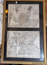
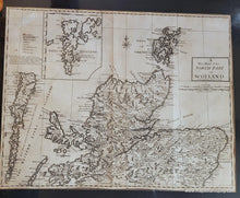
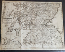
Antique maps of Scotland by Andrew Johnston from Camden's Brittania. It is unclear which edition of the atlas these were published in, possibly 1722 or 1753 (the second and third editions). With excellent detail of towns, roads, and topography depicted pictorially. Inset of the Shetland Islands. These two maps are framed together in one frame. Maps appear to be in good condition with some toning and waviness to the antique paper. There is some paper loss on the left edge of the North Part map. Frame is in good condition but mat appears to have been cut by an amateur and might need to be replaced. Each map measures approx. 14 x 18 inches to the neatline. Total dimensions including the frame are approx. 36.5 x 25 inches. These can be purchased without the frame if desired, but price remains the same.
Item Number: EUR3043


