c. 1640
Maker: Blaeu
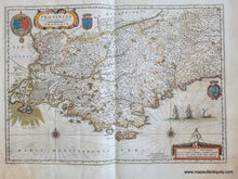
Antique map of part of Provence, France, published by Blaeu, cartographer Petrus Ioannes de Bompar, c. 1640. This map includes Marseilles, Nice, Cannes, Arles, Saint-Tropez, and many other towns and cities in Southern France along the French Riviera (or Côte d'Azur). Highly collectible map with decorative cartouche and scale of miles, coats of arms, two compass roses, and ships in the Mediterranean. It is in good antique condition with some mild staining that could be professionally and archivally cleaned for an additional cost. With a fold as issued. It measures approx. 15.25 x 21.25 inches to the neatline.
Item Number: EUR3047


