Current hours: 10am to 5pm Monday through Saturday. Closed on Sundays. PLEASE NOTE: Our maps are only available at our website www.mapsofantiquity.com or at our store! Stay safe online and use caution if a website looks fishy!

Genuine-Antique-Map-Fort-Devens-Massachusetts-Massachusetts--1943-Engineer-Branch-First-Service-Command-Maps-Of-Antiquity-1800s-19th-century
1943 - Fort Devens, Massachusetts - Antique Map
  • Load image into Gallery viewer, Genuine-Antique-Map-Fort-Devens-Massachusetts-Massachusetts--1943-Engineer-Branch-First-Service-Command-Maps-Of-Antiquity-1800s-19th-century
  • Load image into Gallery viewer, 1943 - Fort Devens, Massachusetts - Antique Map

1943 - Fort Devens, Massachusetts - Antique Map

Regular price
$40.00
Sale price
$40.00
Regular price
Sold out
Unit price
per 
Shipping calculated at checkout.

Item number: MAS2214
Genuine Antique Map

1943

Maker: Engineer Branch, First Service Command.

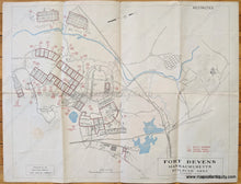
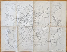
Antique map of Fort Devens in Massachusetts from 1943. Shows the locations of bunks, athletic fields, hospitals, airfield, ponds, rivers, theaters, chapel, and more. Back side shows the greater area around Fort Devens.with roads and railroads. Map is marked Restricted. Fair to good antique condition with some stains, wear at the folds, and small separations at folds. Measures approx. 18 x 23 inches to the neatline.

Item Number: MAS2214