c. 1954
Maker: French Ministry of Travel.
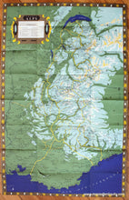
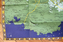
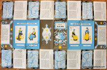
Antique printed color folding tourist map of the French Alps, France, published by the French Ministry of Travel, in English, lithography by Sofcar, with major points of interest including Nice, Cannes, Marseille, Geneva, Mont Blanc, and more, and a key to major roads, castles, churches, ruins, etc., with decorative border of medieval vignettes. Verso features narrative of the area, drawings of Historical Alpine Costumes, and maps of routes through the Alps, including The Route Napoleon or Winter Route and The Route of the Grand Alpes or Summer Route, c. 1954. Good overall antique condition with vivid original color, one V-shaped tear near bottom in the map (can be archivally repaired but this will result in tape on the verso), measures approx. 32.5 x 21 inches unfolded.
Item Number: EUR2499


