Current hours: 10am to 5pm Monday through Saturday. 12pm to 5pm Sundays. IMPORTANT PLEASE NOTE: We have become aware that some of our photos have been stolen by other websites. Our maps are only available at our website www.mapsofantiquity.com or at our store!

Antique-color-lithograph-map-G.A.R.-(Grand-Army-of-the-Republic)-Booklet-Map-of-Illinois-Central-Railroad-Missouri--1887-Matthews/Northup-Maps-Of-Antiquity
1887 - G.A.R. (Grand Army of the Republic) Booklet, Map of Illinois Central Railroad - Antique Map
  • Load image into Gallery viewer, Antique-color-lithograph-map-G.A.R.-(Grand-Army-of-the-Republic)-Booklet-Map-of-Illinois-Central-Railroad-Missouri--1887-Matthews/Northup-Maps-Of-Antiquity
  • Load image into Gallery viewer, 1887 - G.A.R. (Grand Army of the Republic) Booklet, Map of Illinois Central Railroad - Antique Map
  • Load image into Gallery viewer, 1887 - G.A.R. (Grand Army of the Republic) Booklet, Map of Illinois Central Railroad - Antique Map

1887 - G.A.R. (Grand Army of the Republic) Booklet, Map of Illinois Central Railroad - Antique Map

Regular price
$185.00
Sale price
$185.00
Regular price
Sold out
Unit price
per 
Shipping calculated at checkout.

Item number: MWE153
Genuine Antique color lithograph map

1887

Maker: Matthews/Northup.

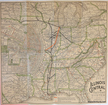
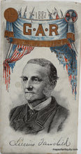
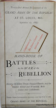
Annual encampment booklet published by the Illinois Central Railroad and dedicated to the GAR, includes engraved color map of the railroad from New Orleans to St. Louis and farther north to Sioux City, Iowa, Chicago, Illinois and Cincinnati, Ohio, with large inset of St. Louis, and marked sites of all Civil War battlefields. Booklet contents include a timeline of battles and casualties for the Civil War and other items such as "Places of Amusement" in St. Louis and a description of the "great steel bridge over the Mississippi." Good condition, map measures 13.5 x 14 inches, folded into booklet measuring 7.25 x 3.75 inches.

Item Number: MWE153