Antique-Topographical-Map-Gardiner's-Island-East-Quadrangle-Long-Island--1947-U.S.-Geological-Survey-Maps-Of-Antiquity
1947 - Gardiner's Island East Quadrangle - Antique Map
  • Load image into Gallery viewer, Antique-Topographical-Map-Gardiner's-Island-East-Quadrangle-Long-Island--1947-U.S.-Geological-Survey-Maps-Of-Antiquity
  • Load image into Gallery viewer, 1947 - Gardiner's Island East Quadrangle - Antique Map
  • Load image into Gallery viewer, 1947 - Gardiner's Island East Quadrangle - Antique Map

1947 - Gardiner's Island East Quadrangle - Antique Map

Regular price
$125.00
Sale price
$125.00
Regular price
Sold out
Unit price
per 
Shipping calculated at checkout.

Item number: NYO533
Genuine Antique Topographical Map

1947

Maker: U.S. Geological Survey.

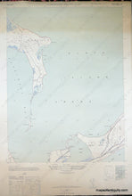
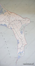
Antique printed color topogrpahical map of the eastern tip of Gardiner's Island, and a portion of East Hampton, New York, including Hither Hills State Park and Napeague Bay and Harbor, and Eastern Plain Point, Tobaccolot Pond and Bay and Great Pond on Gardiner's Island, by the U.S. Geological Survey; with very good color and sharp detail of topography as well as main roads and landmarks, also includes detailed legend and index map to surrounding eight quadrangles. Very good condition with toning upper quarter, measures approx. 23 x 17 inches.

Item Number: NYO533