Winter hours: Tuesday - Saturday 10am to 5pm. Close Sundays and Mondays until May. We appreciate your business!

Antique-Nautical-Chart-General-Chart…Cape-Romain-SC-to-St.-Marys-Entrance-GA-North-America-South-1885-U.S.-Coast-and-Geodetic-Survey-Maps-Of-Antiquity
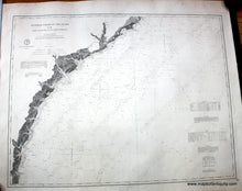
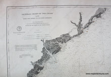
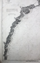
1885 - General Chart... Cape Romain, SC to St. Marys Entrance, GA - Antique Chart
  • Load image into Gallery viewer, Antique-Nautical-Chart-General-Chart…Cape-Romain-SC-to-St.-Marys-Entrance-GA-North-America-South-1885-U.S.-Coast-and-Geodetic-Survey-Maps-Of-Antiquity
  • Load image into Gallery viewer, 1885 - General Chart... Cape Romain, SC to St. Marys Entrance, GA - Antique Chart
  • Load image into Gallery viewer, 1885 - General Chart... Cape Romain, SC to St. Marys Entrance, GA - Antique Chart
  • Load image into Gallery viewer, 1885 - General Chart... Cape Romain, SC to St. Marys Entrance, GA - Antique Chart

1885 - General Chart... Cape Romain, SC to St. Marys Entrance, GA - Antique Chart

Regular price
$750.00
Sale price
$750.00
Regular price
Sold out
Unit price
per 
Shipping calculated at checkout.

Item number: NAU225
Genuine Antique Nautical Chart

1885

Maker: U.S. Coast and Geodetic Survey.

Antique nautical chart - General Chart of the Coast, No. XII, From Cape Romain to St. Marys Entrance, 1882, updated to 1885, includes Hilton Head, Cumberland, Sapello, St. Catherines, St. Simon, St. Jekyll Island, Savannah, and Charleston. Traditional coloring includes lighthouses in yellow and red. Very good overall antique condition with dark clear imprint, about 29 1/2 x 38 inches. This chart has been archivally restored- cleaned, deacidified, and backed. **NOTE- because this map requires extra insurance for shipping, an additional charge will appear on your card after your original purchase. If you would like to know what that charge will be, please contact us.**

Item Number: NAU225