1910
Maker: George W Eldridge.
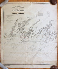
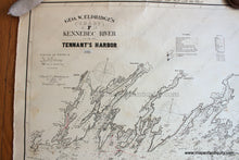
Antique nautical chart of part of the Maine coast, originally published in 1908 and updated to 1910. This is only the western half of Eldridge's Chart F (you can purchase the full chart from our website, subject to availability, model number NAU237). This chart includes Bath, Damariscotta, Waldoboro, Cape Small, Boothbay, Pemaquid, Friendship, Monhegan, Port Clyde, and more. Overall very good condition with some minor stains and edge wear. Neatline is only on three sides. Also has a piece of paper pasted at the title, correcting it to say Tennant's Harbor. Approx. 30.5 x 27 inches to the neatline. **NOTE- because this map requires extra insurance for shipping, an additional charge will appear on your card after your original purchase. If you would like to know what that charge will be, please contact us.**
Item Number: NAU355


