1894
Maker: Cram.
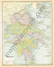
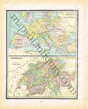
Antique printed color map of Greece (Recto map, page 295) showing longitude East from Greenwich and East from Washington and including an inset of the Cyclades . Verso: Side by side maps of Europe in the time of Napoleon and Switzerland. (page 296) Very good condition with some slight toning at the edges of the page. By Cram, in The Standard Atlas and Gazetteer of The World, 1894. Recto: Approximately 13.75" x 10.5" to the neatline. Verso: Approx. 11.5" x 9.25" to the neatline.
Item Number: EUR1838


