c. 1930
Maker: C.S. Hammond & Co..
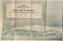
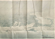
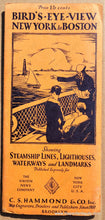
Rare and extraordinary Bird's Eye View Map of New York to Boston, a broad vista showing the Hudson River, Long Island, Manhattan, Connecticut, Rhode Island, and Massachusetts, including Cape Cod, Martha's Vineyard and Nantucket, with lovely detail, showing steamship lines, lighthouses, waterways, landmarks, and noting major points of interest. This map was published during a time of change in the way American traveled: for many years long distance travel was done primarily by boat or train, so this map includes railroads and steamship routes, but with the rising popularity of automobiles, some major roads are included in white. Folding map, good antique condition, with two wrinkles at the top, mild overall toning. We will be trying to smooth the wrinkles with time. Measures approx. 9.25 x 27.75 inches to the edge of the image or 10.75 x 29.25 inches to the paper edges unfolded.
Available as a reproduction: REP297
Item Number: USA078


