1936
Maker: George MacDonald.
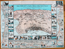
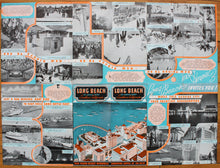
Antique printed color pictorial folding map of Southern California, by George MacDonald for the City of Long Beach, 1936. Shows a bird's eye view of Southern California with topographical details, names of major streets, cities and towns, and points of interest. Includes a surrounding border with activities, historic buildings, places to see, etc. Also includes another general border which details the coast route from Long Beach to Mexico, showing miles traveled and major towns/cities, etc. along the way. Above the map is a passage describing the area, with interesting historical and topical facts. With folds, as issued. Good overall antique condition with some very mild toning throughout, mild roughing of the outer edges, and a couple spots of minor but noticeable paper loss at the fold intersections. Measures approximately 18" x 24" (H x W) in total.
Item Number: WES309


