Reproduction
circa 1732
Maker: Reproduction.
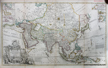
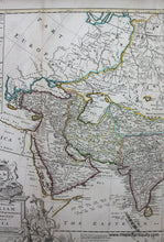
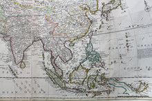
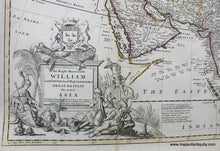
High-quality giclee reproduction map of the entirety of Asia, from Turkey in the west to Japan in the east; the original was from Herman Moll's " The World Described", London, c. 1732. Shows political boundaries, rich detail of cities, towns, and ports, water bodies and landforms. With insets of The Ice Sea, Part of Chusan Island to China, Amoy Island, Hugly River, Bombay, The Gulf of Smirna, and Hellespont and the Straits of Constantinople by Capt. Bamburg. Ornate title richly decorated with illustrations of figures with elephant, and heraldic emblem. Reproduced at a 1:1 size to the original, 23 x 38.5 inches to the neatline. Measured to the edges of the printed area. Paper may be larger but can be trimmed as needed.
Item Number: REP352


