Current hours: 10am to 5pm Tuesday through Saturday. We are closed Sundays and Mondays for the Winter. Proud to be a SMALL, LOCAL, CAPE COD BUSINESS! Maps of Antiquity is in its 38th year! Our maps are only available at our website www.mapsofantiquity.com or at our store!

Genuine-Antique-Map-Earliest-Historic-Regions-and-the-Birthplace-of-Civilization-B-C-3000---1000-verso-Star-Map-No-6-South-Polar-1903-Cram-Maps-Of-Antiquity
  • Load image into Gallery viewer, Genuine-Antique-Map-Earliest-Historic-Regions-and-the-Birthplace-of-Civilization-B-C-3000---1000-verso-Star-Map-No-6-South-Polar-1903-Cram-Maps-Of-Antiquity
  • Load image into Gallery viewer, Genuine-Antique-Map-Earliest-Historic-Regions-and-the-Birthplace-of-Civilization-B-C-3000---1000-verso-Star-Map-No-6-South-Polar-1903-Cram-Maps-Of-Antiquity

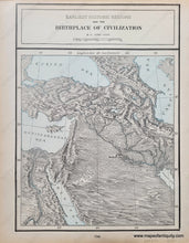
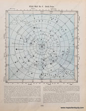
1903 - Earliest Historic Regions and the Birthplace of Civilization B.C. 3000 - 1000. verso: Star Map No. 6 South Polar - Antique Map

Regular price
$75.00
Sale price
$75.00
Regular price
Sold out
Unit price
per 
Shipping calculated at checkout.
 More payment options

Item number: HST031
Genuine Antique Map

1903

Maker: Cram

Antique printed color double-sided map published in Cram's 1903 atlas. On one side is a map of the Middle East including Armenia, Mesopotamia, Babylon, Damascus, Egypt, and more. On the other side is a celestial map of the south pole. Good to very good antique condition with mild smudges mostly in the margins. The printed color is slightly offset. The Civilization map measure approx.13.5 x 9.25 inches to the neatline. The Celestial map measures approx. 9.25 x 9.25 inches to the neatline and has text at the bottom.

Item Number: HST031