Current hours: 10am to 5pm Monday through Saturday. 12pm to 5pm Sundays. We are CLOSED on Christmas Day and New Years Day. We will close early (3pm) on Christmas Eve. IMPORTANT PLEASE NOTE: We have become aware that some of our photos have been stolen by other websites. Our maps are only available at our website www.mapsofantiquity.com or at our store!

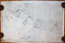
Antique-Nautical-Chart-Indonesia--Sunda-Strait-and-its-Approaches-Nautical-Charts-Asia-General-1884-British-Admiralty-Maps-Of-Antiquity
1884 - Indonesia- Sunda Strait And Its Approaches Antique Chart Genuine Nautical
  • Load image into Gallery viewer, Antique-Nautical-Chart-Indonesia--Sunda-Strait-and-its-Approaches-Nautical-Charts-Asia-General-1884-British-Admiralty-Maps-Of-Antiquity
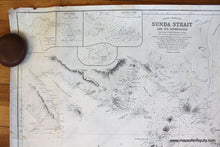
  • Load image into Gallery viewer, 1884 - Indonesia- Sunda Strait And Its Approaches Antique Chart Genuine Nautical
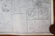
  • Load image into Gallery viewer, 1884 - Indonesia- Sunda Strait And Its Approaches Antique Chart Genuine Nautical

1884 - Indonesia- Sunda Strait and its Approaches - Antique Chart

Regular price
$450.00
Sale price
$450.00
Regular price
Sold out
Unit price
per 
Shipping calculated at checkout.

Item number: NAU271
Genuine Antique Nautical Chart

1884

Maker: British Admiralty.

Antique nautical chart showing part of Indonesia near the Sunda Strait, and including Batavia (or Djakarta). Includes 6 inset maps, 1 blank inset, and one recognition profile. Published by the British Admiralty, originally made in 1868 and corrected up to 1884. Very good condition with some plotting, otherwise generally clean and clear, no tears or repairs. Approx. 25.25 x 38.5 inches to the neatline. **NOTE- because this map requires extra insurance for shipping, an additional charge will appear on your card after your original purchase. If you would like to know what that charge will be, please contact us.**

Item Number: NAU271