Current hours: 10am to 5pm Monday through Saturday. 12pm to 5pm Sundays. We are CLOSED on Christmas Day and New Years Day. We will close early (3pm) on Christmas Eve. IMPORTANT PLEASE NOTE: We have become aware that some of our photos have been stolen by other websites. Our maps are only available at our website www.mapsofantiquity.com or at our store!

Printed-Color-Folding-Map-Invasion-and-Total-War-Victory-Maps-World-War-II--Antique-Military-Maps-World-War-II-1942-Ernest-Dudley-Chase-Maps-Of-Antiquity
1942 - Invasion And Total War Victory Maps World Ii Antique Map Printed-Color Folding
  • Load image into Gallery viewer, Printed-Color-Folding-Map-Invasion-and-Total-War-Victory-Maps-World-War-II--Antique-Military-Maps-World-War-II-1942-Ernest-Dudley-Chase-Maps-Of-Antiquity
  • Load image into Gallery viewer, 1942 - Invasion And Total War Victory Maps World Ii Antique Map Printed-Color Folding
  • Load image into Gallery viewer, 1942 - Invasion And Total War Victory Maps World Ii Antique Map Printed-Color Folding
  • Load image into Gallery viewer, 1942 - Invasion And Total War Victory Maps World Ii Antique Map Printed-Color Folding
  • Load image into Gallery viewer, 1942 - Invasion And Total War Victory Maps World Ii Antique Map Printed-Color Folding

1942 - Invasion and Total War Victory Maps World War II - Antique Map

Regular price
$250.00
Sale price
$250.00
Regular price
Sold out
Unit price
per 
Shipping calculated at checkout.

Item number: MIL013
Printed Color Folding Map

1942

Maker: Ernest Dudley Chase.

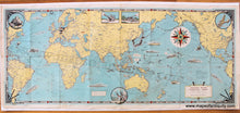
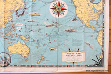
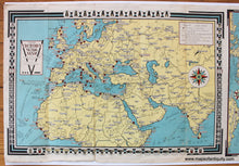
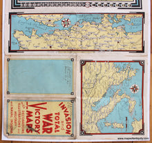
Rare antique printed color folding map of the world created to help people understand where things stood at the beginning of the US involvement in World War II, printed in 1942 and created by Ernest Dudley Chase. This two-sided folding map shows a variety of weapons and vehicles and explains that is it "A battle map to set the stage for 'total war' on land and sea...." The V's for victory are used decoratively throughout the border, which contains Morse code for the letter V ( ...-). On verso are smaller maps of Europe, Italy, and the English Channel. The border of the map of Europe shows military and navy insignia. In fair condition, very fragile with some minor paper loss at fold intersections, some paper separation at folds, some minor stains, some edge wear, slightly deeper creases in some of the folds. Could be restored but at the sacrifice of the image on one side. Priced as is. Approx. 15 x 35 inches to the neatline.

Item Number: MIL013