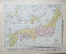
c.1910
Maker: Rand McNally.
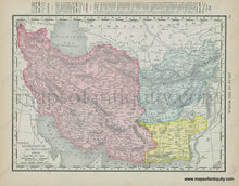
Antique printed color atlas map of Japan's main islands, with inset maps showing The Outline Map of Japan, Formosa and Riukiu Islands (Luchu Islands), and Yezo and Kurile Islands (Chishimia Islands.) On Verso is a map showing portions of present-day Iran, Afghanistan, and Pakistan. Good to Very good overall condition with mild toning throughout, as well as some very minor roughing/small tears at the outer edges of the paper. Each map measures approximately 9.25" x 12.5" (H x W) to the neatline.
Item Number: ASI423


