Genuine Antique Hand-Colored Map
1879
Maker: Walker.
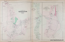
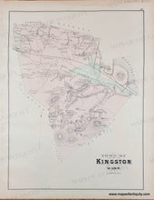
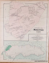
Antique page of maps from the Atlas of Plymouth County, MA, 1879, by Walker. The Centerfold map is Village of Kingston, Village of Rocky Nook (Kingston), and Map of Seaside including the North Part of Plymouth. Versos display the entire Town of Kingston with topographical details, and the Town of Halifax and Plan of Silver Lake. These maps show property owners, named streets, schools, churches, railroads, etc. Original hand-coloring. Good to very good condition, some mild toning, slight darkening along the center fold, slight water stain at top, and some tiny tears at sides. Larger map measures approx. 16 x 26 inches to the neatline.
Genuine Antique Map from 1879
Item Number: MAS1502


