Current hours: 10am to 5pm Monday through Saturday. 12pm to 5pm Sundays. IMPORTANT PLEASE NOTE: We have become aware that some of our photos have been stolen by other websites. Our maps are only available at our website www.mapsofantiquity.com or at our store!

Antique-Printed-Color-Pictorial-Map-Le-Vieux-Carre-de-la-Nouvelle-Orleans-******-United-States-South-1942-Myra-Zimmerman-Baines-Maps-Of-Antiquity
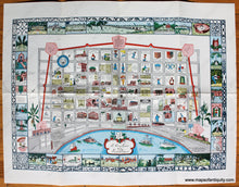
1942/1955 - Le Vieux Carre De La Nouvelle Orleans Antique Pictorial Map Genuine Printed-Color
  • Load image into Gallery viewer, Antique-Printed-Color-Pictorial-Map-Le-Vieux-Carre-de-la-Nouvelle-Orleans-******-United-States-South-1942-Myra-Zimmerman-Baines-Maps-Of-Antiquity
  • Load image into Gallery viewer, 1942/1955 - Le Vieux Carre De La Nouvelle Orleans Antique Pictorial Map Genuine Printed-Color
  • Load image into Gallery viewer, 1942/1955 - Le Vieux Carre De La Nouvelle Orleans Antique Pictorial Map Genuine Printed-Color

1942/1955 - Le Vieux Carre de la Nouvelle Orleans - Antique Pictorial Map

Regular price
$275.00
Sale price
$275.00
Regular price
Sold out
Unit price
per 
Shipping calculated at checkout.

Item number: SOU348
Genuine Antique Printed Color Pictorial Map

1942/1955

Maker: Myra Zimmerman Baines.

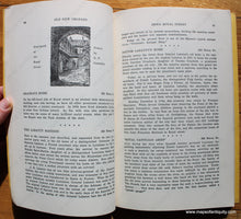
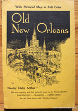
Antique printed color map of New Orleans by Myra Zimmerman Baines, originally printed in 1942, this was included in a book in 1955. Features many sights and vignettes of the city and the border features the city's various lovely cast-iron designs. Very good overall antique condition with folds as issued. This map was in the book Old New Orleans by Stanley Clisby Arthur, published in 1955. Approx. 14 x 19.75 inches to the edge of the printed area.

Item Number: SOU348