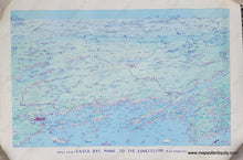
c. 1971
Maker: A.D. Phillips & Son
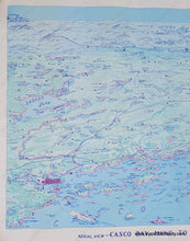
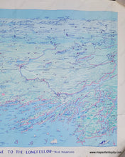
Old bird's-eye view map of Casco Bay published by A.D. Phillips & Son, copyright 1971. This delightful map offers a view of Casco Bay with numerous ships populating the waters, small buildings populating the land, lighthouses, major roads, towns, and the city of Portland on the left side. It includes many beloved cities on the coast of Maine, including Freeport, Brunswick, and Bath. The view extends at the top of the map to include Mount Washington, Sugarloaf Mountain, and Bald Mountain, and small arrows point out the location of Quebec and Montreal in the far distance. Sebago Lake appears on the left side, Androscoggin Lake, the Rangely Lakes and many others dot the landscape. The Northeast Harbor Library has two examples, both of which are different from this map, suggesting that mulitple versions were published. This map has a copyright date of 1971, but it could have been printed somewhat later. Good condition with vertical creases that are stronger at the top, a tear on the right side , and some minor signs of age near the paper edges. Measures approx. 17.5 x 28 inches to the neatline.
Item Number: MAI275


