Genuine Vintage Map
1969
Maker: Culverwell
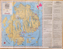
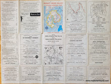
Vintage map of Mount Desert Island, with Acadia National Park, Maine, drawn by Tom Culverwell and published as a visitors map in 1969. Shows roads, campgrounds, towns, some topographic information, etc. Text at right is a visitor's guide. Back side has advertisements. This map was clearly used by someone on a trip, as it includes red marker and pen markings showing their route and noting various things, like "purpoise here"[sic] and "Wildwood Riding Stables." Folds as issued. Text could be folded under for framing. Overall good antique condition with some small stains, mild wrinkles. Map measures approx. 16.25 x 15.25 inches. Total page size is 17.5 x 23 inches.
Item Number: MAI285


