1879
Maker: Mitchell.
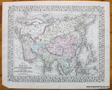
This hand-colored antique map from Mitchell's 1879 New General Atlas shows political boundaries, cities, major towns, water bodies, as well as land and coastal features. Map of Asia Showing its Gt. Political Divisions, and, also, the Various Routes of Travel Between London and India, China and Japan, etc. Other side has a map of the Middle East. This map is in very good antique condition with minimal overall toning and a small tear in the top margin. It measures approximately 13.5 x 11 inches.
Item Number: ASI234


