Current hours: 10am to 5pm Tuesday through Saturday. We are closed Sundays and Mondays for the Winter. Proud to be a SMALL, LOCAL, CAPE COD BUSINESS! Maps of Antiquity is in its 38th year! Our maps are only available at our website www.mapsofantiquity.com or at our store!

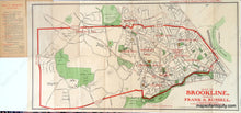
Antique-Printed-Color-Map-Map-of-Brookline-Massachusetts-United-States-Massachusetts-1903-Russell/Forbes-Maps-Of-Antiquity
1903 - Map Of Brookline Massachusetts Antique Genuine Printed-Color
  • Load image into Gallery viewer, Antique-Printed-Color-Map-Map-of-Brookline-Massachusetts-United-States-Massachusetts-1903-Russell/Forbes-Maps-Of-Antiquity
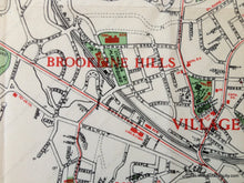
  • Load image into Gallery viewer, 1903 - Map Of Brookline Massachusetts Antique Genuine Printed-Color
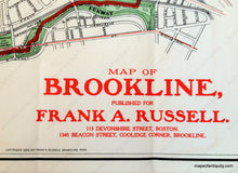
  • Load image into Gallery viewer, 1903 - Map Of Brookline Massachusetts Antique Genuine Printed-Color

1903 - Map of Brookline Massachusetts - Antique Map

Regular price
$350.00
Sale price
$350.00
Regular price
Sold out
Unit price
per 
Shipping calculated at checkout.

Item number: TOW235
Genuine Antique Printed Color Map

1903

Maker: Russell/Forbes.

Antique folding color map of Brookline, Massachusetts at the beginning of the 20th century, published for Frank A. Russell of Boston and Brookline, showing trolley lines, named streets, parks and reservoirs, civic buildings and schools; folds into 5.75 X 2.75 inch cover listing "Some of Brookline's Advantages," and stating, "Brookline is NOT a part of Boston." Very good overall antique condition, map folded out measures 10.5 x 20 inches.

Item Number: TOW235