Current hours: 10am to 5pm Monday through Saturday. Closed on Sundays. PLEASE NOTE: Our maps are only available at our website www.mapsofantiquity.com or at our store! Stay safe online and use caution if a website looks fishy!

Antique-Printed-Color-Map-Map-of-North-Dumfries-Township-&-Map-of-Wilmot-Township-North-America-Canada-1881-Belden-Maps-Of-Antiquity
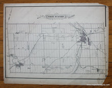
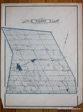
1881 - Map of North Dumfries Township & Map of Wilmot Township - Antique Map
  • Load image into Gallery viewer, Antique-Printed-Color-Map-Map-of-North-Dumfries-Township-&-Map-of-Wilmot-Township-North-America-Canada-1881-Belden-Maps-Of-Antiquity
  • Load image into Gallery viewer, 1881 - Map of North Dumfries Township & Map of Wilmot Township - Antique Map

1881 - Map of North Dumfries Township & Map of Wilmot Township - Antique Map

Regular price
$50.00
Sale price
$50.00
Regular price
Sold out
Unit price
per 
Shipping calculated at checkout.

Item number: CAN253
Genuine Antique Printed Color Map

1881

Maker: Belden.

Antique printed color map of the North Dumfries Township. Verso: Map of the Wilmot Township. Fair condition with overall toning, small tears at the edges (one of which is taped), and two missing corner pieces. By Belden, in The Illustrated Atlas of The Dominion of Canada, 1881. Approximately 12" x 16.5" to the neatline (Reversed for the Wilmot map.) Note: Priced "As Is".

Item Number: CAN253