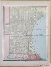
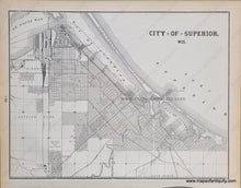
Antique-Printed-Color-Map-Map-of-the-City-of-Milwaukee-and-Bay-View-Wis.-Verso:-City-of-Superior-Wis.-North-America-Midwest-1900-Cram-Maps-Of-Antiquity
  • Load image into Gallery viewer, Antique-Printed-Color-Map-Map-of-the-City-of-Milwaukee-and-Bay-View-Wis.-Verso:-City-of-Superior-Wis.-North-America-Midwest-1900-Cram-Maps-Of-Antiquity
  • Load image into Gallery viewer, Antique-Printed-Color-Map-Map-of-the-City-of-Milwaukee-and-Bay-View-Wis.-Verso:-City-of-Superior-Wis.-North-America-Midwest-1900-Cram-Maps-Of-Antiquity

1900 - Map of the City of Milwaukee and Bay View, Wis., Verso: City of Superior, Wis. - Antique Map

Regular price
$50.00
Sale price
$50.00
Regular price
Sold out
Unit price
per 
Shipping calculated at checkout.

Item number: MWE283
Genuine Antique Printed Color Map

1900

Maker: Cram.


Antique double-sided printed color map of Milwaukee and Bay View, Wisconsin (Recto). Verso: A black and white map of the City of Superior, Wisconsin. Both maps show city streets clearly. Very good condition with some mild overall toning of the page. By Cram, in Cram's Universal Atlas Geographical, Astronomical and Historical, 1900. Recto Map (Milwaukee and Bay View, WI) measures approximately 12" x 9.75" to the neatline. Verso map (Superior, WI) measures approx. 10" x 13" to the neatline. 


Item Number: MWE283