1892
Maker: Home Library & Supply Association.
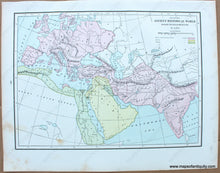
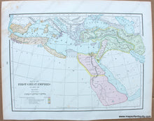
Antique printed color map of the great empires that existed between 3,000-500 B.C. Includes Egypt and Ethiopia, the Assyrian Empire, the Babylonian, Lydian, and Median Empires, the Kingdom of David and Solomon, the Territory of Carthage, and Greece and its colonies. Colored (with a key) to show the separations between these empires (Recto.) On verso: A map of the ancient historical world, colored (with a key) to show the "Caucasian Nations" (Aryan/Indo-European Nations, Semitic, and Hamitic.) Published in "The Pacific Coast and the World" by the Home Library and Supply Association, 1892. Very good overall antique condition with some mild toning/foxing- mainly at the outer edges. Recto Map (First Great Empires) measures approximately 9.25" x 12.5" (H x W) to the neatline. Verso map (Ancient Historical World) measures approx. 9" x 12.5" to the neatline.
Item Number: WOR275


