Current hours: 10am to 5pm Tuesday through Saturday. We are closed Sundays and Mondays until late May. Proud to be a SMALL, LOCAL, CAPE COD BUSINESS! Maps of Antiquity is in its 38th year! Our maps are only available at our website www.mapsofantiquity.com or at our store!

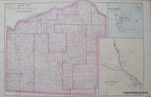
Black-and-White-Engraving-Map-of-Vestal-Township--(NY)**********-United-States-New-York-1876-Everts-Ensign-&-Everts-Maps-Of-Antiquity
1876 - Map Of Vestal Township (Ny) Antique Genuine
  • Load image into Gallery viewer, Black-and-White-Engraving-Map-of-Vestal-Township--(NY)**********-United-States-New-York-1876-Everts-Ensign-&-Everts-Maps-Of-Antiquity
  • Load image into Gallery viewer, 1876 - Map Of Vestal Township (Ny) Antique Genuine
  • Load image into Gallery viewer, 1876 - Map Of Vestal Township (Ny) Antique Genuine

1876 - Map of Vestal Township (NY) - Antique Map

Regular price
$85.00
Sale price
$85.00
Regular price
Sold out
Unit price
per 
Shipping calculated at checkout.

Item number: NYO501
Genuine Antique Map

1876

Maker: Everts, Ensign, & Everts.


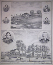
Antique map from the 1876 Broome County Atlas by Everts, Ensign & Everts. Double-sided. Reverse of page contains images of local residences and people. This piece measures approximate 15 x 12 inches and is in Very Good antique condition with some minor foxing and discoloration throughout. **SOLD**


Item Number: NYO501