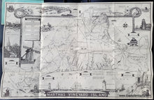
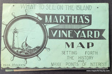
Genuine Antique Pictorial Folding Map
c. 1940
Maker: New England Map Co./L. Parker.
Antique black & white printed pictorial folding map of Martha's Vineyard, produced as a tourist souvenir. These maps were issued in two sizes- this is the larger size. Features many quirky details including corner silhouettes, a partial border depicting woven rope, numerous historical vignettes, descriptions of points of interest, and drawings of island activities. "Come Get a Sparkling Vacation on this Fascinating Island in a Summer Sea Every Season." With folds, as issued. Very good overall antique condition. Map, in its entirety, measures approximately 19" x 29" (H x W) unfolded, and folds into a cover measuring approx. 5.5" x 8.25".
Item Number: MAS1546


