1903/1919
Maker: U.S. Geological Survey
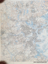
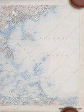
Antique topographical map of the Boston area published in 1903, reprinted in 1919. Covers Hingham, Cohasset, Quincy, Dedham in the south to Salem, Stoneham, Burlington in the north, Waltham and Newton in the west to Minots Ledge in the East. With Cambridge, Somerville, Charlestown, Brookline, Jamaica Plain, and more. This map shows towns, cities, topography, roads, railroads, islands, etc. Very good antique condition wth minor wear and stains at paper edges. Measures approx. 28.25 x 20 inches.
Item Number: MAS2248


