Current hours: 10am to 5pm Monday through Saturday. Closed on Sundays. IMPORTANT PLEASE NOTE: We have become aware that some of our photos have been stolen by other websites. Our maps are only available at our website www.mapsofantiquity.com or at our store!

Genuine-Antique-Map-Map-of-the-Town-of-Wrentham-Norfolk-County-Massachusetts-1851-Walling-Maps-Of-Antiquity
  • Load image into Gallery viewer, Genuine-Antique-Map-Map-of-the-Town-of-Wrentham-Norfolk-County-Massachusetts-1851-Walling-Maps-Of-Antiquity
  • Load image into Gallery viewer, Genuine-Antique-Map-Map-of-the-Town-of-Wrentham-Norfolk-County-Massachusetts-1851-Walling-Maps-Of-Antiquity
  • Load image into Gallery viewer, Genuine-Antique-Map-Map-of-the-Town-of-Wrentham-Norfolk-County-Massachusetts-1851-Walling-Maps-Of-Antiquity
  • Load image into Gallery viewer, Genuine-Antique-Map-Map-of-the-Town-of-Wrentham-Norfolk-County-Massachusetts-1851-Walling-Maps-Of-Antiquity
  • Load image into Gallery viewer, Genuine-Antique-Map-Map-of-the-Town-of-Wrentham-Norfolk-County-Massachusetts-1851-Walling-Maps-Of-Antiquity
  • Load image into Gallery viewer, Genuine-Antique-Map-Map-of-the-Town-of-Wrentham-Norfolk-County-Massachusetts-1851-Walling-Maps-Of-Antiquity

1851 - Map of the Town of Wrentham, Norfolk County, Massachusetts - Antique Map

Regular price
$675.00
Sale price
$675.00
Regular price
Sold out
Unit price
per 
Shipping calculated at checkout.

Item number: MAS2259
Genuine Antique Map

1851

Maker: Walling

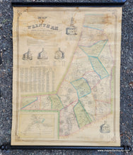
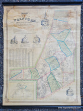
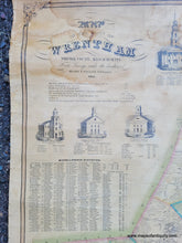
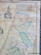
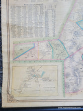
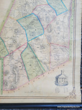
Antique wall map of Wrentham, MA, by Henry F. Walling, 1851. One of the earliest town maps of Wrentham, this wall map is full of interesting details. It shows topography, carriage roads, an early railroad call the Norfolk County Railroad, forests, swamps, villages, and more. It includes the name of every property owner at the time, with an inset of the more densely populated town center. It also features illustrations of the various churches, with lists of the ministers of each church going back to the 18th century. Also a table of Miscellaneous Statistics, including Town Officers, Representatives, State Senators, Lawyers, Justices of the Peace, census information, and the names of University Graduates. General information about the town is set under the title. Overall a delightfully interesting map. Good to very good antique condition with some water staining at the top and wear along the sides where the original silk ribbon has deteriorated. On original rods. Measures approx. 31 x 23 inches to the neatline of the map. Overall approx. 35 x 30 inches including the rods. Could be restored for an additional cost.

Item Number: MAS2259