Current hours: 10am to 5pm Monday through Saturday. Closed on Sundays. PLEASE NOTE: Our maps are only available at our website www.mapsofantiquity.com or at our store! Stay safe online and use caution if a website looks fishy!

Genuine-Antique-Map-Plate-18-Brookline-Mass--1893-Richards-Maps-Of-Antiquity
1893 - Plate 18, Brookline, Mass. - Antique Map
  • Load image into Gallery viewer, Genuine-Antique-Map-Plate-18-Brookline-Mass--1893-Richards-Maps-Of-Antiquity
  • Load image into Gallery viewer, 1893 - Plate 18, Brookline, Mass. - Antique Map

1893 - Plate 18, Brookline, Mass. - Antique Map

Regular price
$125.00
Sale price
$125.00
Regular price
Sold out
Unit price
per 
Shipping calculated at checkout.

Item number: MAS2353
Genuine Antique Map

1893

Maker: Richards

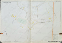
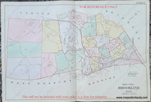
Antique map from the Atlas of the Town of Brookline, Massachusetts, by L.J. Richards & Co., 1893. Shows streets, railroads, bodies of water, etc. Includes a large Country Club. This map was made for tax and insurance purposes. Each property owner is labeled and the color of the building indicates the material is is made of: purple/grey is stone, pink is brick, yellow is frame (wood). Very good condition with some minor small tears and stains. The leather tab is still attached and left a stain on the page. Slight wear at the paper edges. Measures approx. 20 x 30 inches to the neatline.

Item Number: MAS2353