Pickup available at 1409 MAIN ST, CHATHAM MA
Usually ready in 24 hours
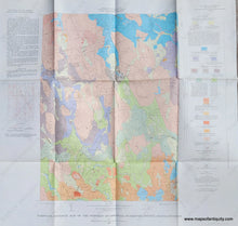
1967 - Surficial Geology of the Whitman Quadrangle, Massachusetts - Antique Map
-
1409 MAIN ST, CHATHAM MA
Pickup available, usually ready in 24 hours1409 Main Street
Chatham MA 02633
United States+15089451660
1967
Maker: Richard G Petersen and Charles E Shaw, Jr. / US Geological Survey
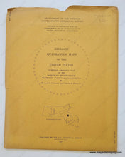
Vintage geologic map of Whitman MA and the nearby area, published in 1967 by the US Geological Survey. With information about the geology with a base map surveyed in 1962 and geology mapped in 1957-58 and 1964. Includes Rockland, Abington, East Bridgewater, Hanson, Brockton, Halifax, etc. with roads, railroads, swamps, rivers, ponds, and more. This map comes in an outer jacket. Very good condition with folds as issued and a few tiny spots and some wear along the fold lines. Measures approx. 28 x 30 inches to the paper edges.
Item Number: MAS2439


