1861
Maker: Smith
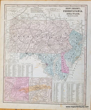
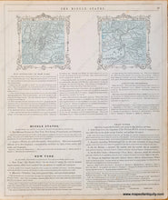
Antique map of the Mid-Atlantic with Pennsylvania, New Jersey, Maryland and Delaware from Smith's School Geography, 1861. Inset maps of the vicinity of Pittsburgh and the vicinity of Baltimore. Tables indicate the counties, their abbreviations, capitals, and population as of 1850. Fair to good condition with some staining especially in the lower portion of the page. Measures approx. 12 x 10 inches to the neatline. Verso has geography questions and small maps of New York City and Buffalo (Small maps each measure approx. 3.75" x 3.75", including decorative border.)
Item Number: MAT312


