Current hours: 10am to 5pm Monday through Saturday. 12pm to 5pm Sundays. We are CLOSED on Christmas Day and New Years Day. We will close early (3pm) on Christmas Eve. IMPORTANT PLEASE NOTE: We have become aware that some of our photos have been stolen by other websites. Our maps are only available at our website www.mapsofantiquity.com or at our store!

Antique-Hand-Colored-Folding-Map-Mogg's-New-Map-of-the-Country-Forty-Five-Miles-Round-London-Europe-England-1827-Mogg-Maps-Of-Antiquity-1800s-19th-century
1827 - Mogg’s New Map Of The Country Forty-Five Miles Round London Antique Genuine Hand-Colored
  • Load image into Gallery viewer, Antique-Hand-Colored-Folding-Map-Mogg's-New-Map-of-the-Country-Forty-Five-Miles-Round-London-Europe-England-1827-Mogg-Maps-Of-Antiquity-1800s-19th-century
  • Load image into Gallery viewer, 1827 - Mogg’s New Map Of The Country Forty-Five Miles Round London Antique Genuine Hand-Colored
  • Load image into Gallery viewer, 1827 - Mogg’s New Map Of The Country Forty-Five Miles Round London Antique Genuine Hand-Colored
  • Load image into Gallery viewer, 1827 - Mogg’s New Map Of The Country Forty-Five Miles Round London Antique Genuine Hand-Colored
  • Load image into Gallery viewer, 1827 - Mogg’s New Map Of The Country Forty-Five Miles Round London Antique Genuine Hand-Colored

1827 - Mogg's New Map of the Country Forty-Five Miles Round London - Antique Map

Regular price
$495.00
Sale price
$495.00
Regular price
Sold out
Unit price
per 
Shipping calculated at checkout.

Item number: EUR2675
Genuine Antique Hand Colored Folding Map

1827

Maker: Mogg.

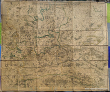
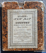
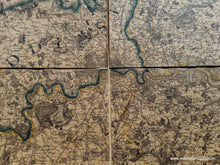
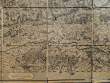
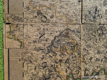
Antique hand colored folding map of the vicinity of London, published by Edward Mogg in 1827. Includes the original slip case with printed label. As the case says, the map includes "the Counties of Middlesex and Surrey; nearly the whole of Buckinghamshire, Hertfordshire, Essex, and Kent; with very considerable Portions of Sussex, Bedfordshire, Berkshire, Hampshire & Oxfordshire; and a part of Suffolk." Shows topography, towns, cities, parks (country estates), etc. Colored outlines around each county, although much of the color seems to have faded. This map is in 36 sections mounted on linen. Slipcase is damaged with one side torn. Map is very toned overall with minor paper loss and minor seam separations. Measures approx. 46 x 39 inches. **NOTE- because this map requires extra insurance for shipping, an additional charge will appear on your card after your original purchase. If you would like to know what that charge will be, please contact us.**

Item Number: EUR2675